
Sora topographic map
Interactive map
Click on the map to display elevation.
About this map
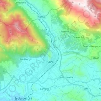
Name: Sora topographic map, elevation, terrain.
Location: Sora, FR, Latium, 03039, Italien (41.68789 13.50279 41.77797 13.65464)
Average elevation: 604 m
Minimum elevation: 209 m
Maximum elevation: 1,885 m