
Hatop topographic map
Interactive map
Click on the map to display elevation.
About this map
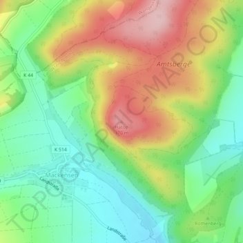
Name: Hatop topographic map, elevation, terrain.
Location: Hatop, Dassel, Landkreis Northeim, Niedersachsen, Deutschland (51.82735 9.67662 51.82745 9.67672)
Average elevation: 265 m
Minimum elevation: 177 m
Maximum elevation: 389 m
Other topographic maps
Click on a map to view its topography, its elevation and its terrain.
Markoldendorf
Deutschland > Niedersachsen > Landkreis Northeim > Dassel
Markoldendorf, Dassel, Landkreis Northeim, Niedersachsen, Deutschland
Average elevation: 150 m