
Thank you for supporting this site ❤️
Make a donation
Make a donation
Gear up for your next adventure:
As an Amazon Associate, this site earns from qualifying purchases at no extra cost to you.
Tomösteng topographic map
Click on the map to display elevation.
Thank you for supporting this site ❤️
Make a donation
Make a donation
Gear up for your next adventure:
As an Amazon Associate, this site earns from qualifying purchases at no extra cost to you.
About this map
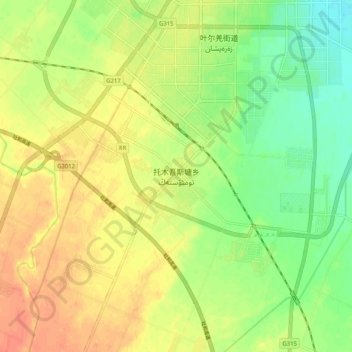
Name: Tomösteng topographic map, elevation, terrain.
Location: Tomösteng, Yarkant County, Kashgar Prefecture, Xinjiang, China (38.32258 77.18961 38.40258 77.26961)
Average elevation: 1,238 m
Minimum elevation: 1,214 m
Maximum elevation: 1,259 m
Thank you for supporting this site ❤️
Make a donation
Make a donation
Gear up for your next adventure:
As an Amazon Associate, this site earns from qualifying purchases at no extra cost to you.