
Thank you for supporting this site ❤️
Make a donation
Make a donation
Gear up for your next adventure:
As an Amazon Associate, this site earns from qualifying purchases at no extra cost to you.
Unterhaching topographic map
Click on the map to display elevation.
Thank you for supporting this site ❤️
Make a donation
Make a donation
Gear up for your next adventure:
As an Amazon Associate, this site earns from qualifying purchases at no extra cost to you.
About this map
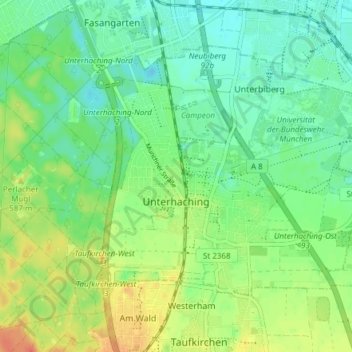
Name: Unterhaching topographic map, elevation, terrain.
Location: Unterhaching, Landkreis München, Bavaria, 82008, Germany (48.05234 11.57481 48.08735 11.65048)
Average elevation: 556 m
Minimum elevation: 539 m
Maximum elevation: 583 m
Thank you for supporting this site ❤️
Make a donation
Make a donation
Gear up for your next adventure:
As an Amazon Associate, this site earns from qualifying purchases at no extra cost to you.