
Gandra topographic map
Interactive map
Click on the map to display elevation.
About this map
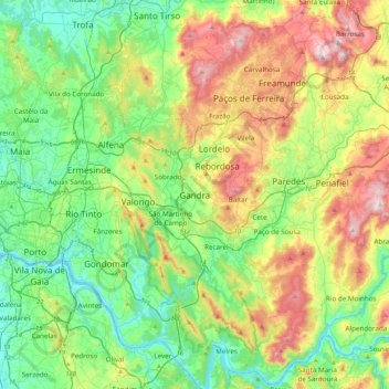
Name: Gandra topographic map, elevation, terrain.
Location: Gandra, Paredes, Porto, 4585-352, Portugal (41.03632 -8.59597 41.35632 -8.27597)
Average elevation: 190 m
Minimum elevation: 0 m
Maximum elevation: 577 m