
Thank you for supporting this site ❤️
Make a donation
Make a donation
Gear up for your next adventure:
As an Amazon Associate, this site earns from qualifying purchases at no extra cost to you.
Roberton topographic map
Click on the map to display elevation.
Thank you for supporting this site ❤️
Make a donation
Make a donation
Gear up for your next adventure:
As an Amazon Associate, this site earns from qualifying purchases at no extra cost to you.
About this map
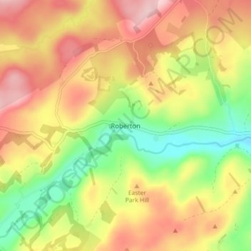
Name: Roberton topographic map, elevation, terrain.
Location: Roberton, Scottish Borders, Scotland, TD9 7LX, United Kingdom (55.39928 -2.91960 55.43928 -2.87960)
Average elevation: 244 m
Minimum elevation: 136 m
Maximum elevation: 345 m
Thank you for supporting this site ❤️
Make a donation
Make a donation
Gear up for your next adventure:
As an Amazon Associate, this site earns from qualifying purchases at no extra cost to you.