
Make a donation
Gear up for your next adventure:
As an Amazon Associate, this site earns from qualifying purchases at no extra cost to you.
Couchiching topographic map
Click on the map to display elevation.
Make a donation
Gear up for your next adventure:
As an Amazon Associate, this site earns from qualifying purchases at no extra cost to you.
About this map
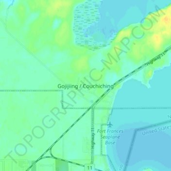
Name: Couchiching topographic map, elevation, terrain.
Average elevation: 340 m
Minimum elevation: 334 m
Maximum elevation: 357 m
Make a donation
Gear up for your next adventure:
As an Amazon Associate, this site earns from qualifying purchases at no extra cost to you.
Other topographic maps
Click on a map to view its topography, its elevation and its terrain.
Quetico Lake
Canada > Ontario > Rainy River District > Unorganized Rainy River
Average elevation: 399 m
Make a donation
Gear up for your next adventure:
As an Amazon Associate, this site earns from qualifying purchases at no extra cost to you.
Otukamamoan Lake
Canada > Ontario > Rainy River District > Unorganized Rainy River
Average elevation: 368 m
Obabikon Lake
Canada > Ontario > Rainy River District > Lake of the Woods Township
Average elevation: 335 m
Make a donation
Gear up for your next adventure:
As an Amazon Associate, this site earns from qualifying purchases at no extra cost to you.
French River
Canada > Ontario > Rainy River District > Unorganized Rainy River
Average elevation: 439 m
Little Eva Lake
Canada > Ontario > Rainy River District > Unorganized Rainy River
Average elevation: 357 m
Make a donation
Gear up for your next adventure:
As an Amazon Associate, this site earns from qualifying purchases at no extra cost to you.
La Vallee Township
Canada > Ontario > Rainy River District > La Vallee Township
Average elevation: 354 m
Helmet Lake
Canada > Ontario > Rainy River District > Unorganized Rainy River
Average elevation: 454 m
Make a donation
Gear up for your next adventure:
As an Amazon Associate, this site earns from qualifying purchases at no extra cost to you.