Geolocate

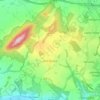
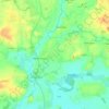
High Ercall topographic map

Click on the map to display elevation.

About this map

Name: High Ercall topographic map, elevation, terrain.

Location: High Ercall, Telford and Wrekin, England, TF6 6AG, United Kingdom (52.73270 -2.62442 52.77270 -2.58442)

Average elevation: 66 m

Minimum elevation: 49 m

Maximum elevation: 86 m

Other topographic maps

Click on a map to view its topography, its elevation and its terrain.
Madeley

United Kingdom > England > Telford and Wrekin

Average elevation: 116 m

Play Park

United Kingdom > England > Telford and Wrekin > Dawley

Average elevation: 176 m

Edgmond

United Kingdom > England > Telford and Wrekin > Edgmond

Average elevation: 73 m

Ketley

United Kingdom > England > Telford and Wrekin > Telford

Average elevation: 127 m

Madeley

United Kingdom > England > Telford and Wrekin

Average elevation: 116 m

Madeley

United Kingdom > England > Telford and Wrekin

Average elevation: 116 m

Madeley

United Kingdom > England > Telford and Wrekin

Average elevation: 116 m

Edgmond

United Kingdom > England > Telford and Wrekin > Edgmond

Average elevation: 73 m

Gear up for your next adventure:

🌲Bushcraft Skills Books - Learn navigation, fire-making, and shelter building
🧯Camp Safety Kits - All‑in‑one safety gear
🧴Anti-Chafe Sticks - Prevent friction during long distance walking
🍽️Camping Utensil Sets - Complete eating sets
🧤Touchscreen Glove Liners - Use your mapping app without freezing your hands

As an Amazon Associate, this site earns from qualifying purchases at no extra cost to you.