
Thank you for supporting this site ❤️
Make a donation
Make a donation
Gear up for your next adventure:
As an Amazon Associate, this site earns from qualifying purchases at no extra cost to you.
Kanyoni topographic map
Click on the map to display elevation.
Thank you for supporting this site ❤️
Make a donation
Make a donation
Gear up for your next adventure:
As an Amazon Associate, this site earns from qualifying purchases at no extra cost to you.
About this map
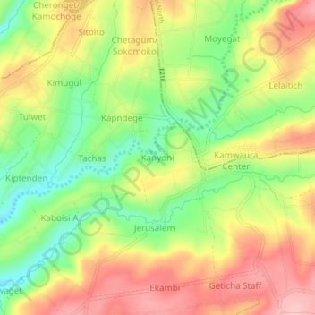
Name: Kanyoni topographic map, elevation, terrain.
Location: Kanyoni, Tinet ward, Kuresoi South, Nakuru, Rift Valley, Kenya (-0.43269 35.55061 -0.39269 35.59061)
Average elevation: 2,530 m
Minimum elevation: 2,451 m
Maximum elevation: 2,606 m
Thank you for supporting this site ❤️
Make a donation
Make a donation
Gear up for your next adventure:
As an Amazon Associate, this site earns from qualifying purchases at no extra cost to you.