
Thank you for supporting this site ❤️
Make a donation
Make a donation
Gear up for your next adventure:
As an Amazon Associate, this site earns from qualifying purchases at no extra cost to you.
Balzac topographic map
Click on the map to display elevation.
Thank you for supporting this site ❤️
Make a donation
Make a donation
Gear up for your next adventure:
As an Amazon Associate, this site earns from qualifying purchases at no extra cost to you.
About this map
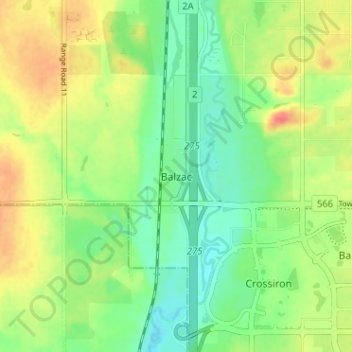
Name: Balzac topographic map, elevation, terrain.
Location: Balzac, Rocky View County, Alberta, T0M 0E0, Canada (51.19561 -114.02456 51.23561 -113.98456)
Average elevation: 1,088 m
Minimum elevation: 1,066 m
Maximum elevation: 1,117 m
Thank you for supporting this site ❤️
Make a donation
Make a donation
Gear up for your next adventure:
As an Amazon Associate, this site earns from qualifying purchases at no extra cost to you.