
Thank you for supporting this site ❤️
Make a donation
Make a donation
Gear up for your next adventure:
As an Amazon Associate, this site earns from qualifying purchases at no extra cost to you.
Gmoa topographic map
Click on the map to display elevation.
Thank you for supporting this site ❤️
Make a donation
Make a donation
Gear up for your next adventure:
As an Amazon Associate, this site earns from qualifying purchases at no extra cost to you.
About this map
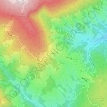
Name: Gmoa topographic map, elevation, terrain.
Location: Gmoa, Fischbach, Bezirk Weiz, Styria, 8654, Austria (47.42519 15.61788 47.46519 15.65788)
Average elevation: 1,067 m
Minimum elevation: 771 m
Maximum elevation: 1,487 m
Thank you for supporting this site ❤️
Make a donation
Make a donation
Gear up for your next adventure:
As an Amazon Associate, this site earns from qualifying purchases at no extra cost to you.