
Make a donation
Gear up for your next adventure:
As an Amazon Associate, this site earns from qualifying purchases at no extra cost to you.
Holzlar topographic map
Click on the map to display elevation.
Make a donation
Gear up for your next adventure:
As an Amazon Associate, this site earns from qualifying purchases at no extra cost to you.
Holzlar
Holzlar stößt im Westen an den Höhenzug Ennert, der zum größten Teil mit Mischwald, darunter teilweise stattlichen Eichen überzogen ist und zum Naturschutzgebiet Siebengebirge, nicht jedoch zum Naturpark Siebengebirge gehört; er schirmt Holzlar vom Rheintal ab.
Make a donation
Gear up for your next adventure:
As an Amazon Associate, this site earns from qualifying purchases at no extra cost to you.
About this map
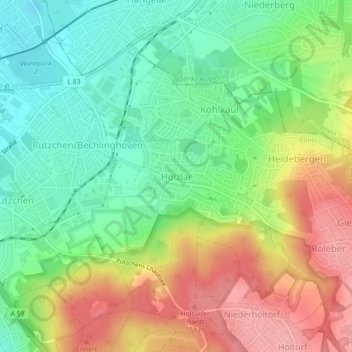
Name: Holzlar topographic map, elevation, terrain.
Average elevation: 101 m
Minimum elevation: 54 m
Maximum elevation: 164 m
Make a donation
Gear up for your next adventure:
As an Amazon Associate, this site earns from qualifying purchases at no extra cost to you.