Geolocate

Lucsuhin topographic map

Click on the map to display elevation.

About this map
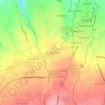
Name: Lucsuhin topographic map, elevation, terrain.

Location: Lucsuhin, Silang, Cavite, Calabarzon, 4118, Philippines (14.19121 120.94058 14.23121 120.98058)

Average elevation: 338 m

Minimum elevation: 263 m

Maximum elevation: 389 m

Other topographic maps

Click on a map to view its topography, its elevation and its terrain.

Carmen

Philippines > Cavite > Silang

Average elevation: 172 m

Carmen

Philippines > Cavite > Silang

Average elevation: 172 m

Carmen

Philippines > Cavite > Silang

Average elevation: 172 m

Gear up for your next adventure:

🎧Wireless Earbuds - Music on the move
🪓Camping Hand Axes - For processing wood during forest camping
🎒Hiking Backpacks - Durable backpacks for day hikes and multi‑day treks
🧢Hiking Hats & Caps - Protective headwear for sun and rain
🩻Outdoor Health Essentials - Necessary health items for hikes

As an Amazon Associate, this site earns from qualifying purchases at no extra cost to you.