
Thank you for supporting this site ❤️
Make a donation
Make a donation
Gear up for your next adventure:
As an Amazon Associate, this site earns from qualifying purchases at no extra cost to you.
jeerango topographic map
Click on the map to display elevation.
Thank you for supporting this site ❤️
Make a donation
Make a donation
Gear up for your next adventure:
As an Amazon Associate, this site earns from qualifying purchases at no extra cost to you.
About this map
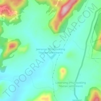
Name: jeerango topographic map, elevation, terrain.
Location: jeerango, Mohana, Gajapati, Odisha, 761017, India (19.25171 84.24173 19.29171 84.28173)
Average elevation: 630 m
Minimum elevation: 564 m
Maximum elevation: 827 m
Thank you for supporting this site ❤️
Make a donation
Make a donation
Gear up for your next adventure:
As an Amazon Associate, this site earns from qualifying purchases at no extra cost to you.