
Make a donation
Gear up for your next adventure:
As an Amazon Associate, this site earns from qualifying purchases at no extra cost to you.
Las Lomas topographic map
Click on the map to display elevation.
Make a donation
Gear up for your next adventure:
As an Amazon Associate, this site earns from qualifying purchases at no extra cost to you.
Las Lomas
Las Lomas (Spanish for 'The Hills') is an unincorporated community and census-designated place (CDP) in Monterey County, California, United States. Las Lomas is located 7 miles (11 km) north-northwest of Prunedale. The elevation is 43 feet (13 m). The population was 3,046 at the 2020 census.
Make a donation
Gear up for your next adventure:
As an Amazon Associate, this site earns from qualifying purchases at no extra cost to you.
About this map
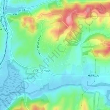
Name: Las Lomas topographic map, elevation, terrain.
Average elevation: 35 m
Minimum elevation: -6 m
Maximum elevation: 118 m
Make a donation
Gear up for your next adventure:
As an Amazon Associate, this site earns from qualifying purchases at no extra cost to you.