
المعونة topographic map
Interactive map
Click on the map to display elevation.
About this map
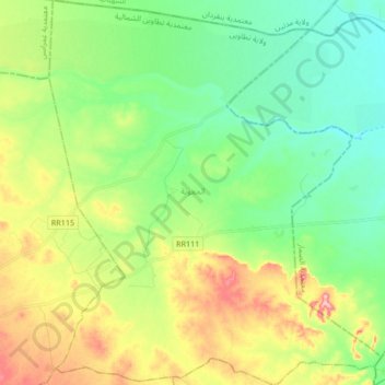
Name: المعونة topographic map, elevation, terrain.
Location: المعونة, تطاوين الشمالية, Tataouine, Tunisia (32.96785 10.60564 33.10875 10.75092)
Average elevation: 125 m
Minimum elevation: 77 m
Maximum elevation: 213 m