
Sham Shui Po District topographic map
Interactive map
Click on the map to display elevation.
About this map
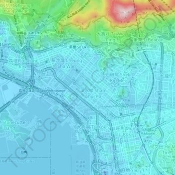
Name: Sham Shui Po District topographic map, elevation, terrain.
Location: Sham Shui Po District, Hong Kong, PRC (22.31330 114.13029 22.34879 114.17686)
Average elevation: 57 m
Minimum elevation: -31 m
Maximum elevation: 438 m
Other topographic maps
Click on a map to view its topography, its elevation and its terrain.