
Thank you for supporting this site ❤️
Make a donation
Make a donation
Gear up for your next adventure:
As an Amazon Associate, this site earns from qualifying purchases at no extra cost to you.
Nafra topographic map
Click on the map to display elevation.
Thank you for supporting this site ❤️
Make a donation
Make a donation
Gear up for your next adventure:
As an Amazon Associate, this site earns from qualifying purchases at no extra cost to you.
About this map
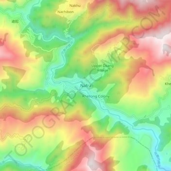
Name: Nafra topographic map, elevation, terrain.
Location: Nafra, Nafra EAC, Bichom, Arunachal Pradesh, India (27.33166 92.50509 27.41166 92.58509)
Average elevation: 1,453 m
Minimum elevation: 814 m
Maximum elevation: 2,262 m
Thank you for supporting this site ❤️
Make a donation
Make a donation
Gear up for your next adventure:
As an Amazon Associate, this site earns from qualifying purchases at no extra cost to you.