Geolocate

Polleur topographic map

Click on the map to display elevation.

About this map
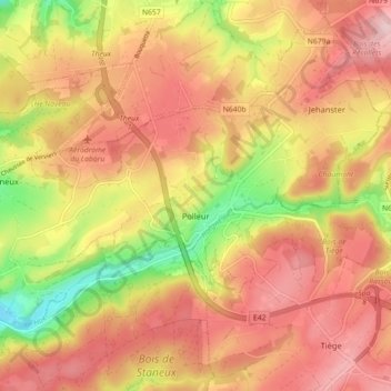
Name: Polleur topographic map, elevation, terrain.

Location: Polleur, Theux, Verviers, Liège, Wallonia, 4910, Belgium (50.51831 5.83198 50.56763 5.92114)

Average elevation: 307 m

Minimum elevation: 141 m

Maximum elevation: 383 m

Other topographic maps

Click on a map to view its topography, its elevation and its terrain.

Sur les Villers

Belgium > Liège > Verviers > Theux

Average elevation: 226 m

Tancrémont

Belgium > Liège > Verviers > Theux

Average elevation: 223 m

Vert Buisson

Belgium > Liège > Verviers > Theux

Average elevation: 403 m

Gear up for your next adventure:

🧦Merino Wool Socks - Moisture-wicking and blister-preventing trail socks
🥾Waterproof Hiking Boots - Best waterproof boots for wet Irish weather
🧗Rock Climbing Gear - Essentials for the cliffs of Moher or Gap of Dunloe
📊Altimeters & Barometers - Track elevation and weather changes
🎿Skiing Gear - Winter sports essentials

As an Amazon Associate, this site earns from qualifying purchases at no extra cost to you.