
Thank you for supporting this site ❤️
Make a donation
Make a donation
Gear up for your next adventure:
As an Amazon Associate, this site earns from qualifying purchases at no extra cost to you.
Palavaram topographic map
Click on the map to display elevation.
Thank you for supporting this site ❤️
Make a donation
Make a donation
Gear up for your next adventure:
As an Amazon Associate, this site earns from qualifying purchases at no extra cost to you.
About this map
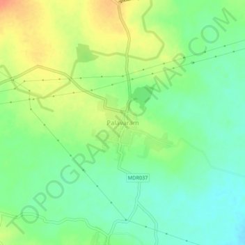
Name: Palavaram topographic map, elevation, terrain.
Location: Palavaram, Chatrai, Eluru district, Andhra Pradesh, India (16.96263 80.89324 17.00263 80.93324)
Average elevation: 94 m
Minimum elevation: 75 m
Maximum elevation: 120 m
Thank you for supporting this site ❤️
Make a donation
Make a donation
Gear up for your next adventure:
As an Amazon Associate, this site earns from qualifying purchases at no extra cost to you.