Geolocate

Palodeia topographic map

Click on the map to display elevation.

About this map
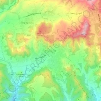
Name: Palodeia topographic map, elevation, terrain.

Location: Palodeia, Limassol District, Cyprus, 4549, Cyprus (34.72845 32.98472 34.76845 33.02472)

Average elevation: 280 m

Minimum elevation: 144 m

Maximum elevation: 459 m

Gear up for your next adventure:

🧗Rock Climbing Gear - Essentials for the cliffs of Moher or Gap of Dunloe
🔪Multi‑Tools & Knives - Versatile tools for outdoor tasks
🔋Lithium Batteries - Best performance for digital devices in cold weather
🔋Rechargeable Batteries - Eco-friendly power for headlamps and GPS units
🎒Day Packs - Perfect packs for day trips

As an Amazon Associate, this site earns from qualifying purchases at no extra cost to you.