Geolocate

Burney topographic map

Click on the map to display elevation.

About this map

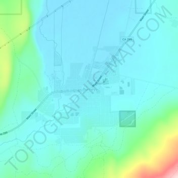
Name: Burney topographic map, elevation, terrain.

Location: Burney, Shasta County, California, 96013, United States (40.86238 -121.68082 40.90238 -121.64082)

Average elevation: 989 m

Minimum elevation: 943 m

Maximum elevation: 1,221 m

Gear up for your next adventure:

🌿Irish Flora Guides - Identify plants while exploring the countryside
🏕️Family Camping Sets - Gear packages for family trips
🎧Wireless Earbuds - Music on the move
🌲Bushcraft Skills Books - Learn navigation, fire-making, and shelter building
🚰Hydration Packs - Hands‑free water storage for hikers

As an Amazon Associate, this site earns from qualifying purchases at no extra cost to you.