
Arañuel topographic map
Interactive map
Click on the map to display elevation.
About this map
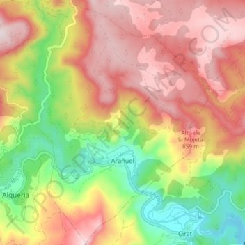
Name: Arañuel topographic map, elevation, terrain.
Average elevation: 652 m
Minimum elevation: 347 m
Maximum elevation: 918 m
Other topographic maps
Click on a map to view its topography, its elevation and its terrain.
El Plano
España > Comunidad Valenciana > Castellón > Arañuel
El Plano, Arañuel, El Alto Mijares, Castellón, Comunidad Valenciana, 12231, España
Average elevation: 796 m