
山南市 topographic map
Interactive map
Click on the map to display elevation.
About this map
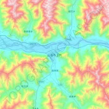
Name: 山南市 topographic map, elevation, terrain.
Location: 山南市, 泽当街道, 乃东区, 山南市, Tibet, China (29.07909 91.61057 29.39909 91.93057)
Average elevation: 4,148 m
Minimum elevation: 3,542 m
Maximum elevation: 5,430 m