
Ließen topographic map
Interactive map
Click on the map to display elevation.
About this map
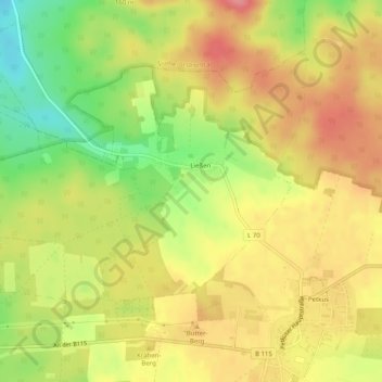
Name: Ließen topographic map, elevation, terrain.
Location: Ließen, Baruth/Mark, Teltow-Fläming, Brandenburg, Deutschland (51.98665 13.30682 52.00950 13.35715)
Average elevation: 135 m
Minimum elevation: 84 m
Maximum elevation: 173 m
Other topographic maps
Click on a map to view its topography, its elevation and its terrain.
Petkus
Deutschland > Brandenburg > Teltow-Fläming > Baruth/Mark
Petkus, Baruth/Mark, Teltow-Fläming, Brandenburg, Deutschland
Average elevation: 127 m