Geolocate

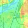
Channahon topographic map

Click on the map to display elevation.

About this map

Name: Channahon topographic map, elevation, terrain.

Location: Channahon, Channahon Township, Will County, Illinois, 60410, United States (41.37640 -88.38716 41.48654 -88.17191)

Average elevation: 171 m

Minimum elevation: 132 m

Maximum elevation: 211 m

Other topographic maps

Click on a map to view its topography, its elevation and its terrain.
Drummond

United States > Illinois > Will County

Average elevation: 167 m

Marley

United States > Illinois > Will County

Average elevation: 214 m

Puddle Pond

United States > Illinois > Will County > Plainfield

Average elevation: 187 m

Arbury Hills

United States > Illinois > Will County

Average elevation: 216 m

Gear up for your next adventure:

⛺Emergency Bivvy Bags - Life-saving heat-reflective shelter for emergencies
🎒Fully Waterproof Rucksacks - Submersible protection for river crossings
🏃Men's Trail Runners - Grip and speed for rugged Irish mountain running
💳Travel Cards for Ireland - Convenient payment abroad
🛌Cold Weather Sleeping Bags - Warm sleeping bags for colder hikes

As an Amazon Associate, this site earns from qualifying purchases at no extra cost to you.