Geolocate

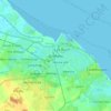
Laceby topographic map

Click on the map to display elevation.

About this map

Name: Laceby topographic map, elevation, terrain.

Location: Laceby, North East Lincolnshire, Greater Lincolnshire, England, United Kingdom (53.52066 -0.19604 53.55526 -0.13559)

Average elevation: 23 m

Minimum elevation: 4 m

Maximum elevation: 67 m

Other topographic maps

Click on a map to view its topography, its elevation and its terrain.
Gear up for your next adventure:

🥛Insulated Flasks - Keep drinks hot or cold
💡Hiking Headlamps - Hands‑free lights for night hikes
🎒Waterproof Backpacks - Protect your gear from rain on Irish hikes
🧢Waterproof Caps - Keep rain off your face and glasses while hiking
🥣Outdoor Food & Meals - Dehydrated meals for backpacking

As an Amazon Associate, this site earns from qualifying purchases at no extra cost to you.