Geolocate

Center topographic map

Click on the map to display elevation.

About this map

Name: Center topographic map, elevation, terrain.

Location: Center, Shelby County, Texas, 75935, United States (31.76645 -94.21010 31.81895 -94.14955)

Average elevation: 99 m

Minimum elevation: 75 m

Maximum elevation: 120 m

Other topographic maps

Click on a map to view its topography, its elevation and its terrain.
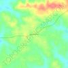
Mount Herman

United States > Texas > Shelby County

Average elevation: 124 m

Gear up for your next adventure:

🔌Travel Adapters - Essential for visitors to charge gear in Ireland
⛺Ultralight Hiking Tents - Compact shelters for multi-day wild camping in Ireland
🥛Insulated Flasks - Keep drinks hot or cold
🔋Rechargeable Batteries - Eco-friendly power for headlamps and GPS units
🪵Fire Starters & Tools - Tools to start fire in wet conditions

As an Amazon Associate, this site earns from qualifying purchases at no extra cost to you.