
Priverno topographic map
Interactive map
Click on the map to display elevation.
About this map
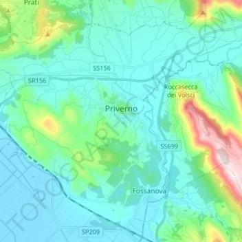
Name: Priverno topographic map, elevation, terrain.
Location: Priverno, Latina, Latium, 04015, Italien (41.41806 13.10833 41.51699 13.22720)
Average elevation: 123 m
Minimum elevation: -3 m
Maximum elevation: 724 m
Priverno liegt auf dem Höhenrücken des Monte Saiano, einem Ausläufer der Monti Lepini oberhalb der Pontinischen Ebene. Es ist Sitz der Comunità Montana Monti Lepini e Ausoni.
Other topographic maps
Click on a map to view its topography, its elevation and its terrain.