
Thank you for supporting this site ❤️
Make a donation
Make a donation
Gear up for your next adventure:
As an Amazon Associate, this site earns from qualifying purchases at no extra cost to you.
DeWitt topographic map
Click on the map to display elevation.
Thank you for supporting this site ❤️
Make a donation
Make a donation
Gear up for your next adventure:
As an Amazon Associate, this site earns from qualifying purchases at no extra cost to you.
About this map
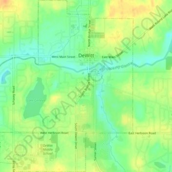
Name: DeWitt topographic map, elevation, terrain.
Location: DeWitt, Clinton County, Michigan, 48820, United States (42.82023 -84.59722 42.85303 -84.55757)
Average elevation: 256 m
Minimum elevation: 239 m
Maximum elevation: 272 m
Thank you for supporting this site ❤️
Make a donation
Make a donation
Gear up for your next adventure:
As an Amazon Associate, this site earns from qualifying purchases at no extra cost to you.