
Make a donation
Gear up for your next adventure:
As an Amazon Associate, this site earns from qualifying purchases at no extra cost to you.
Mohmand Agency topographic map
Click on the map to display elevation.
Make a donation
Gear up for your next adventure:
As an Amazon Associate, this site earns from qualifying purchases at no extra cost to you.
About this map
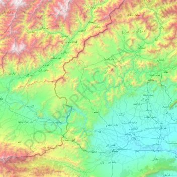
Name: Mohmand Agency topographic map, elevation, terrain.
Average elevation: 1,237 m
Minimum elevation: 281 m
Maximum elevation: 4,436 m
Make a donation
Gear up for your next adventure:
As an Amazon Associate, this site earns from qualifying purchases at no extra cost to you.
Other topographic maps
Click on a map to view its topography, its elevation and its terrain.
Bajaur District
Bajaur is about 45 miles (72 km) long and 20 miles (32 km) wide. It lies at a high elevation to the east of the Kunar Valley of Afghanistan from which it is separated by a continuous line of rugged frontier hills. The old road from Afghanistan's Kabul to Pakistan went through Bajaur before a new pass, Khyber…
Average elevation: 1,172 m
Former Chitrāl District
Pakistan > Khyber Pakhtunkhwa > Former Chitrāl District
Chitral is connected to the rest of Pakistan by two major road routes, the Lowari Pass (el. 10,230 ft.) from Dir and Shandur Top (elevation 12,200 ft.) from Gilgit. Both routes used to be closed in winter, but circa 2017 the highway Lowari Tunnel under the Lowari Pass opened to vehicular traffic for at least…
Average elevation: 3,729 m
Make a donation
Gear up for your next adventure:
As an Amazon Associate, this site earns from qualifying purchases at no extra cost to you.