
Make a donation
Gear up for your next adventure:
As an Amazon Associate, this site earns from qualifying purchases at no extra cost to you.
Blatzheim topographic map
Click on the map to display elevation.
Make a donation
Gear up for your next adventure:
As an Amazon Associate, this site earns from qualifying purchases at no extra cost to you.
About this map
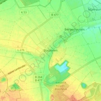
Name: Blatzheim topographic map, elevation, terrain.
Average elevation: 101 m
Minimum elevation: 80 m
Maximum elevation: 118 m
Make a donation
Gear up for your next adventure:
As an Amazon Associate, this site earns from qualifying purchases at no extra cost to you.
Other topographic maps
Click on a map to view its topography, its elevation and its terrain.
Schloss Türnich
Deutschland > Nordrhein-Westfalen > Rhein-Erft-Kreis > Kerpen > Türnich
Das rechteckige Herrenhaus der Anlage ist ein hell verputzter Backsteinbau im westlichen Bereich der Schlossinsel. Sein Grundriss misst etwa 33,15 × 18,70 Meter und ähnelt stark dem des Jagdschlosses Falkenlust in Brühl, das François de Cuvilliés für den Kölner Kurfürsten Clemens August von Bayern…
Average elevation: 87 m
Make a donation
Gear up for your next adventure:
As an Amazon Associate, this site earns from qualifying purchases at no extra cost to you.
Kiesgrube Steinheide
Deutschland > Nordrhein-Westfalen > Rhein-Erft-Kreis > Kerpen > Manheim
Average elevation: 89 m