
Make a donation
Gear up for your next adventure:
As an Amazon Associate, this site earns from qualifying purchases at no extra cost to you.
Ogilby topographic map
Click on the map to display elevation.
Make a donation
Gear up for your next adventure:
As an Amazon Associate, this site earns from qualifying purchases at no extra cost to you.
About this map
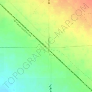
Name: Ogilby topographic map, elevation, terrain.
Location: Ogilby, Imperial County, California, United States (32.80699 -114.84885 32.82699 -114.82885)
Average elevation: 109 m
Minimum elevation: 87 m
Maximum elevation: 132 m
Make a donation
Gear up for your next adventure:
As an Amazon Associate, this site earns from qualifying purchases at no extra cost to you.
Other topographic maps
Click on a map to view its topography, its elevation and its terrain.
Brawley
United States > California > Imperial County
Brawley is located in the Colorado Desert and Lower Colorado River Valley regions. The city's elevation, like other Imperial Valley towns, is below sea level.
Average elevation: -36 m
Make a donation
Gear up for your next adventure:
As an Amazon Associate, this site earns from qualifying purchases at no extra cost to you.
Calipatria
United States > California > Imperial County
At an elevation of 180 feet (55 m) below sea level, Calipatria is the lowest incorporated city in the Western Hemisphere. The city currently claims to have the "tallest flagpole (184 feet) where the flag flies at sea level" at 184 feet (56 m), so their American flag will always fly above sea level. According…
Average elevation: -50 m
Make a donation
Gear up for your next adventure:
As an Amazon Associate, this site earns from qualifying purchases at no extra cost to you.
Bombay Beach
United States > California > Imperial County
The derelict "living ghost town" status of Bombay Beach has attracted many photographers, filmmakers, urban explorers, and tourists. The town, as well as others on the shores of the Salton Sea, is one of the lowest settlements in elevation in North America. The local American Legion, Post 801, had 36 members…
Average elevation: -61 m
Calipatria
United States > California > Imperial County
At an elevation of 180 feet (55 m) below sea level, Calipatria is the lowest incorporated city in the Western Hemisphere. The city currently claims to have the "tallest flagpole (184 feet) where the flag flies at sea level" at 184 feet (56 m), so their American flag will always fly above sea level. According…
Average elevation: -53 m
Make a donation
Gear up for your next adventure:
As an Amazon Associate, this site earns from qualifying purchases at no extra cost to you.