

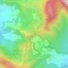
Kopo topographic map
Click on the map to display elevation.
About this map

Name: Kopo topographic map, elevation, terrain.
Location: Kopo, Cisarua, Bogor, West Java, 16750, Indonesia (-6.68453 106.89486 -6.65258 106.92785)
Average elevation: 732 m
Minimum elevation: 560 m
Maximum elevation: 891 m
Other topographic maps
Click on a map to view its topography, its elevation and its terrain.
Puncak Pass
Indonesia > West Java > Bogor > Cisarua > Tugu Utara
Puncak or Puncak Pass (Old Dutch: Poentjak; lit. 'top' or 'peak') is a mountain pass in Cisarua District, Bogor Regency, West Java, Indonesia. The pass connects the cities of Bogor and Bandung and is spread within the regencies of Bogor and Cianjur. Puncak Pass is located between Mt. Gede-Pangrango in the…
Average elevation: 1,406 m