
Thank you for supporting this site ❤️
Make a donation
Make a donation
Gear up for your next adventure:
As an Amazon Associate, this site earns from qualifying purchases at no extra cost to you.
Beget topographic map
Click on the map to display elevation.
Thank you for supporting this site ❤️
Make a donation
Make a donation
Gear up for your next adventure:
As an Amazon Associate, this site earns from qualifying purchases at no extra cost to you.
About this map
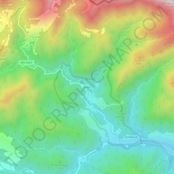
Name: Beget topographic map, elevation, terrain.
Location: Beget, Camprodon, Ripollès, Girona, Catalonia, 17867, Spain (42.30088 2.46015 42.34088 2.50015)
Average elevation: 761 m
Minimum elevation: 445 m
Maximum elevation: 1,336 m
Thank you for supporting this site ❤️
Make a donation
Make a donation
Gear up for your next adventure:
As an Amazon Associate, this site earns from qualifying purchases at no extra cost to you.