
Thank you for supporting this site ❤️
Make a donation
Make a donation
Gear up for your next adventure:
As an Amazon Associate, this site earns from qualifying purchases at no extra cost to you.
Kipili topographic map
Click on the map to display elevation.
Thank you for supporting this site ❤️
Make a donation
Make a donation
Gear up for your next adventure:
As an Amazon Associate, this site earns from qualifying purchases at no extra cost to you.
About this map
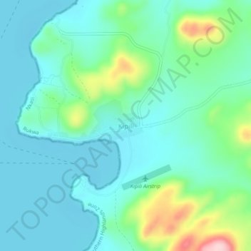
Name: Kipili topographic map, elevation, terrain.
Location: Kipili, Nkasi, Rukwa Region, Southern Highlands Zone, Tanzania (-7.46195 30.58429 -7.42195 30.62429)
Average elevation: 812 m
Minimum elevation: 763 m
Maximum elevation: 984 m
Thank you for supporting this site ❤️
Make a donation
Make a donation
Gear up for your next adventure:
As an Amazon Associate, this site earns from qualifying purchases at no extra cost to you.