
Raoucheh topographic map
Interactive map
Click on the map to display elevation.
About this map
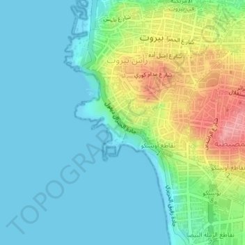
Name: Raoucheh topographic map, elevation, terrain.
Location: Raoucheh, Ras Beirut, Beirut Governorate, Lebanon (33.88234 35.46823 33.89079 35.47921)
Average elevation: 29 m
Minimum elevation: -1 m
Maximum elevation: 109 m