
Oconee County topographic map
Interactive map
Click on the map to display elevation.
About this map
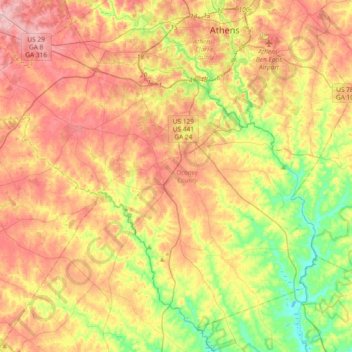
Name: Oconee County topographic map, elevation, terrain.
Location: Oconee County, Georgia, United States (33.69831 -83.64703 33.96573 -83.27621)
Average elevation: 209 m
Minimum elevation: 133 m
Maximum elevation: 283 m
Other topographic maps
Click on a map to view its topography, its elevation and its terrain.
Flint River Dam
United States > Georgia > Dougherty County > Albany > Lakeside
Average elevation: 61 m
Atlanta
United States > Georgia > Fulton County
Atlanta (/ætˈlæntə/ at-LAN-tə) is the capital and most populous city of the U.S. state of Georgia. It lies primarily within Fulton County (for which it serves as county seat), with about 10% of the city lying within neighboring DeKalb County. With a population of 498,715 living within the city limits, it…
Average elevation: 285 m