Geolocate

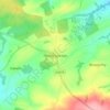
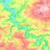
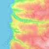
Shebbear topographic map

Click on the map to display elevation.

About this map

Name: Shebbear topographic map, elevation, terrain.

Location: Shebbear, Torridge District, Devon, Devon and Torbay, England, United Kingdom (50.83412 -4.26167 50.91467 -4.18186)

Average elevation: 136 m

Minimum elevation: 70 m

Maximum elevation: 191 m

Other topographic maps

Click on a map to view its topography, its elevation and its terrain.

Earthquake

United Kingdom > England > Devon > Torridge District

Average elevation: 35 m

Clawton

United Kingdom > England > Devon > Torridge District

Average elevation: 128 m

Riddlecombe

United Kingdom > England > Devon > Torridge District

Average elevation: 156 m

Derril

United Kingdom > England > Devon > Torridge District > Pyworthy

Average elevation: 127 m

Chilsworthy

United Kingdom > England > Devon > Torridge District

Average elevation: 139 m

Venngreen

United Kingdom > England > Devon > Torridge District

Average elevation: 149 m

Churchtown

United Kingdom > England > Devon > Torridge District

Average elevation: 115 m

Horns Cross

United Kingdom > England > Devon > Torridge District

Average elevation: 112 m

Diddywells

United Kingdom > England > Devon > Torridge District > Northam

Average elevation: 19 m

Taddiport

United Kingdom > England > Devon > Torridge District

Average elevation: 85 m

Stibb Cross

United Kingdom > England > Devon > Torridge District

Average elevation: 157 m

Ashmill

United Kingdom > England > Devon > Torridge District > Ashwater

Average elevation: 156 m

Stoke

United Kingdom > England > Devon > Torridge District > Hartland

Average elevation: 76 m

Woodacott

United Kingdom > England > Devon > Torridge District > Thornbury

Average elevation: 138 m

Hollocombe

United Kingdom > England > Devon > Torridge District

Average elevation: 149 m

Appledore

United Kingdom > England > Devon > Torridge District

Average elevation: 19 m

Luckcroft

United Kingdom > England > Devon > Torridge District

Average elevation: 157 m

Earthquake

United Kingdom > England > Devon > Torridge District

Average elevation: 35 m

Fairy Cross

United Kingdom > England > Devon > Torridge District

Average elevation: 88 m

Appledore

United Kingdom > England > Devon > Torridge District

Average elevation: 21 m

Diddywells

United Kingdom > England > Devon > Torridge District > Northam

Average elevation: 19 m

Gear up for your next adventure:

🔒Outdoor Gear Locks - Secure your equipment
🪀Camping Games - Fun for group camping trips
🧴Long-Lasting Sunscreen - Protect against UV rays during long days on the ridges
🪓Camping Axes & Hatchets - Wood cutting tools for campsite prep
🔭Portable Monoculars - One-handed optics for quick route checking

As an Amazon Associate, this site earns from qualifying purchases at no extra cost to you.