
Zillebeke topographic map
Interactive map
Click on the map to display elevation.
About this map
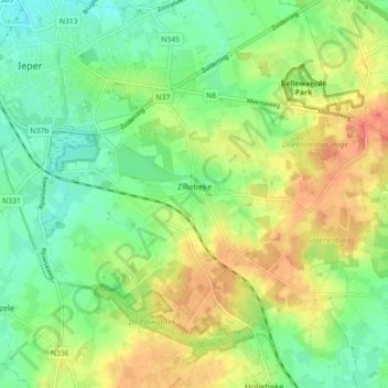
Name: Zillebeke topographic map, elevation, terrain.
Location: Zillebeke, Ypres, Ieper, West Flanders, Flanders, Belgium (50.81278 2.88746 50.85426 2.97656)
Average elevation: 36 m
Minimum elevation: 11 m
Maximum elevation: 70 m