Calvert topographic map
Click on the map to display elevation.
Calvert
The Main Line railway passes through Calvert as does Western Creek, a tributary of the Bremer River. A 2014 flood mapping study of the Western Creek catchment has provided more reliable flood information to residents and landowners. In the northern extents elevations rise to 340 metres above sea level around Mount Grandchester No. 2. which is part of the Little Liverpool Range. The landscape in the southern parts of Calvert is mostly used for agriculture.
About this map
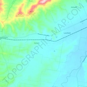
Name: Calvert topographic map, elevation, terrain.
Location: Calvert, Ipswich City, Queensland, 4340, Australia (-27.71852 152.46944 -27.61777 152.54780)
Average elevation: 96 m
Minimum elevation: 41 m
Maximum elevation: 380 m
Other topographic maps
Click on a map to view its topography, its elevation and its terrain.