
Thank you for supporting this site ❤️
Make a donation
Make a donation
Gear up for your next adventure:
As an Amazon Associate, this site earns from qualifying purchases at no extra cost to you.
Prypiat topographic map
Click on the map to display elevation.
Thank you for supporting this site ❤️
Make a donation
Make a donation
Gear up for your next adventure:
As an Amazon Associate, this site earns from qualifying purchases at no extra cost to you.
About this map
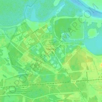
Name: Prypiat topographic map, elevation, terrain.
Location: Prypiat, Vyshhorod Raion, Kyiv Oblast, Ukraine (51.39446 30.02756 51.41603 30.08274)
Average elevation: 111 m
Minimum elevation: 100 m
Maximum elevation: 123 m
Thank you for supporting this site ❤️
Make a donation
Make a donation
Gear up for your next adventure:
As an Amazon Associate, this site earns from qualifying purchases at no extra cost to you.