Geolocate

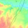
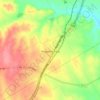
Bellmead topographic map

Click on the map to display elevation.

About this map

Name: Bellmead topographic map, elevation, terrain.

Location: Bellmead, McLennan County, Texas, 76705, United States (31.57291 -97.12324 31.63103 -97.06051)

Average elevation: 135 m

Minimum elevation: 119 m

Maximum elevation: 153 m

Other topographic maps

Click on a map to view its topography, its elevation and its terrain.
Elm Mott

United States > Texas > McLennan County

Average elevation: 156 m

South Bosque

United States > Texas > McLennan County > Waco

Average elevation: 161 m

Cameron Park

United States > Texas > McLennan County > Waco

Average elevation: 137 m

Waco

United States > Texas > McLennan County > Waco

Average elevation: 150 m

Hewitt

United States > Texas > McLennan County > Hewitt > Hewitt

Average elevation: 189 m

Bruceville-Eddy

United States > Texas > McLennan County

Average elevation: 198 m

Gear up for your next adventure:

🌦️Weatherproof Outdoor Gear - Protection from unpredictable weather
📱Phone Holders for Biking - Secure phone mounts for touring cyclists
🛶Inflatable Touring Kayaks - Explore Irish loughs and coastal topography
🛸Lightweight Camera Drones - Capture stunning aerial topographic views of the landscape
🔦High-Lumen Headlamps - Hands-free lighting for early starts or late finishes

As an Amazon Associate, this site earns from qualifying purchases at no extra cost to you.