Geolocate

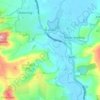
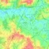
Dial Post topographic map

Click on the map to display elevation.

About this map

Name: Dial Post topographic map, elevation, terrain.

Location: Dial Post, Horsham, West Sussex, England, RH13 8QS, United Kingdom (50.94335 -0.37785 50.98335 -0.33785)

Average elevation: 20 m

Minimum elevation: 4 m

Maximum elevation: 54 m

Other topographic maps

Click on a map to view its topography, its elevation and its terrain.

Itchingfield

United Kingdom > England > West Sussex > Horsham

Average elevation: 51 m

Bramber

United Kingdom > England > West Sussex > Horsham

Average elevation: 40 m

Nuthurst

United Kingdom > England > West Sussex > Horsham

Average elevation: 60 m

Rudgwick

United Kingdom > England > West Sussex > Horsham

Average elevation: 50 m

Ashington

United Kingdom > England > West Sussex > Horsham

Average elevation: 33 m

Slinfold

United Kingdom > England > West Sussex > Horsham

Average elevation: 47 m

Thakeham

United Kingdom > England > West Sussex > Horsham

Average elevation: 31 m

Upper Beeding

United Kingdom > England > West Sussex > Horsham

Average elevation: 38 m

West Grinstead

United Kingdom > England > West Sussex > Horsham

Average elevation: 21 m

Shipley

United Kingdom > England > West Sussex > Horsham

Average elevation: 27 m

River Adur

United Kingdom > England > West Sussex > Horsham

Average elevation: 49 m

Warnham

United Kingdom > England > West Sussex > Horsham

Average elevation: 59 m

Upper Beeding

United Kingdom > England > West Sussex > Horsham

Average elevation: 38 m

Gear up for your next adventure:

👣Waterproof Leg Gaiters - Keep bog water and debris out of your boots
🩻Outdoor Health Essentials - Necessary health items for hikes
📷Compact Binoculars - High-definition optics for scouting terrain and wildlife
💡Hiking Headlamps - Hands‑free lights for night hikes
🪀Camping Games - Fun for group camping trips

As an Amazon Associate, this site earns from qualifying purchases at no extra cost to you.