
Brahmaputra River topographic map
Interactive map
Click on the map to display elevation.
About this map
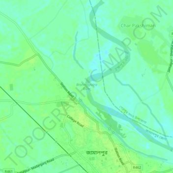
Name: Brahmaputra River topographic map, elevation, terrain.
Average elevation: 18 m
Minimum elevation: 12 m
Maximum elevation: 23 m
The course of the Brahmaputra River has changed drastically in the past two and a half centuries, moving its river course westwards for a distance of about 80 km (50 mi), leaving its old river course, appropriately named the old Brahmaputra river, behind. In the past, the floodplain of the old river course had soils which were more properly formed compared to graded sediments on the operating Jamuna river. This change of river course resulted in modifications to the soil-forming process, which include acidification, the breakdown of clays and buildup of organic matter, with the soils showing an increasing amount of biotic homogenization, mottling, the coating around Peds and maturing soil arrangement, shape and pattern. In the future, the consequences of local ground subsidence coupled with flood prevention propositions, for instance, localised breakwaters, that increase flood-plain water depths outside the water breakers, may alter the water levels of the floodplains. Throughout the years, bars, scroll bars, and sand dunes are formed at the edge of the flood plain by deposition. The height difference of the channel topography is often not more than 1m-2m. Furthermore, flooding over the history of the river has caused the formation of river levees due to deposition from the overbank flow. The height difference between the levee top and the surrounding floodplains is typically 1m along small channels and 2-3m along major channels. Crevasse splay, a sedimentary fluvial deposit which forms when a stream breaks its natural or artificial levees and deposits sediment on a floodplain, are often formed due to a breach in the levee, forming a lobe of sediments which progrades onto the adjacent floodplain. Lastly, flood basins are often formed between the levees of adjacent rivers.