
Thank you for supporting this site ❤️
Make a donation
Make a donation
Gear up for your next adventure:
As an Amazon Associate, this site earns from qualifying purchases at no extra cost to you.
Monreal/Elo topographic map
Click on the map to display elevation.
Thank you for supporting this site ❤️
Make a donation
Make a donation
Gear up for your next adventure:
As an Amazon Associate, this site earns from qualifying purchases at no extra cost to you.
About this map
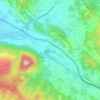
Name: Monreal/Elo topographic map, elevation, terrain.
Location: Monreal/Elo, Pirinioaurrea / Prepirineo, Navarre, Spain (42.67699 -1.57262 42.73502 -1.47351)
Average elevation: 681 m
Minimum elevation: 484 m
Maximum elevation: 1,277 m
Thank you for supporting this site ❤️
Make a donation
Make a donation
Gear up for your next adventure:
As an Amazon Associate, this site earns from qualifying purchases at no extra cost to you.