Geolocate

Ledge Point topographic map

Click on the map to display elevation.

About this map
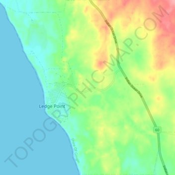
Name: Ledge Point topographic map, elevation, terrain.

Location: Ledge Point, Western Australia, Australia (-31.13586 115.34928 -31.06485 115.42535)

Average elevation: 29 m

Minimum elevation: -1 m

Maximum elevation: 92 m

Gear up for your next adventure:

🚰Portable Water Filters - Safely drink from Irish streams and mountain lakes
🎽Thermal Base Layers - Essential moisture management for cold weather
🛶Inflatable Touring Kayaks - Explore Irish loughs and coastal topography
🧭Hiking Compasses - Reliable compasses for navigation off‑trail
🛍️Outdoor Accessory Kits - Bundles for new hikers

As an Amazon Associate, this site earns from qualifying purchases at no extra cost to you.