
Thank you for supporting this site ❤️
Make a donation
Make a donation
Gear up for your next adventure:
As an Amazon Associate, this site earns from qualifying purchases at no extra cost to you.
Cachada topographic map
Click on the map to display elevation.
Thank you for supporting this site ❤️
Make a donation
Make a donation
Gear up for your next adventure:
As an Amazon Associate, this site earns from qualifying purchases at no extra cost to you.
About this map
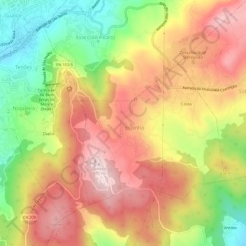
Name: Cachada topographic map, elevation, terrain.
Location: Cachada, Espinho, Braga, 4715-613, Portugal (41.52848 -8.38420 41.56848 -8.34420)
Average elevation: 393 m
Minimum elevation: 182 m
Maximum elevation: 570 m
Thank you for supporting this site ❤️
Make a donation
Make a donation
Gear up for your next adventure:
As an Amazon Associate, this site earns from qualifying purchases at no extra cost to you.