
Thank you for supporting this site ❤️
Make a donation
Make a donation
Gear up for your next adventure:
As an Amazon Associate, this site earns from qualifying purchases at no extra cost to you.
KATAMBALANG topographic map
Click on the map to display elevation.
Thank you for supporting this site ❤️
Make a donation
Make a donation
Gear up for your next adventure:
As an Amazon Associate, this site earns from qualifying purchases at no extra cost to you.
About this map
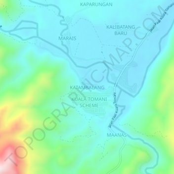
Name: KATAMBALANG topographic map, elevation, terrain.
Location: KATAMBALANG, Tenom, Interior Division, Sabah, Malaysia (4.82897 115.86202 4.86897 115.90202)
Average elevation: 303 m
Minimum elevation: 204 m
Maximum elevation: 706 m
Thank you for supporting this site ❤️
Make a donation
Make a donation
Gear up for your next adventure:
As an Amazon Associate, this site earns from qualifying purchases at no extra cost to you.