
Segorbe topographic map
Interactive map
Click on the map to display elevation.
About this map
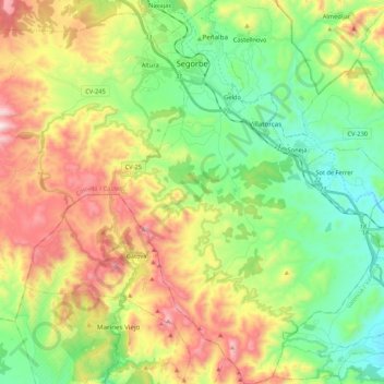
Name: Segorbe topographic map, elevation, terrain.
Average elevation: 485 m
Minimum elevation: 190 m
Maximum elevation: 961 m
Other topographic maps
Click on a map to view its topography, its elevation and its terrain.
Montanejos
Spain > Valencian Community > Castelló / Castellón
Montanejos, l'Alt Millars, Castelló / Castellón, Valencian Community, 12448, Spain
Average elevation: 682 m
Castellnovo
Spain > Valencian Community > Castelló / Castellón
Castellnovo, l'Alt Palància, Castelló / Castellón, Valencian Community, 12413, Spain
Average elevation: 363 m
Viver
Spain > Valencian Community > Castelló / Castellón
Viver, l'Alt Palància, Castelló / Castellón, Valencian Community, 12460, Spain
Average elevation: 665 m